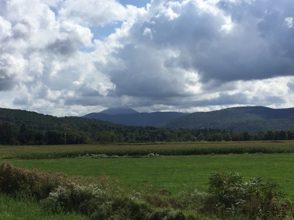
Stratocumulus clouds covering Camels Hump. View from I-89 off-ramp in Richmond
How tall are those clouds?
Note: this post is the answer to a natural history quiz post to my instagram account.
A couple days ago as I was driving out to visit my mom in Richmond, I was appreciating the beautiful biscuity clouds hanging low in the sky. The Green Mountains in the distance were blotted with shade cast by the thick layer of clouds, only the highest peaks of Mt Mansfield and Camels Hump extending up into the stratocumulus clouds. Even on clear days the highest peaks of the state seem to have a cloud lingering over them.
Back in the 70s, UVM professor and naturalist extraordinaire, Thomas Siccama, was trying to pin down what exactly controlled the change in vegetation as you climbed up Camels Hump (link), and in particular, why there was an alpine zone at just over 4,000′ in Vermont (out west it’s closer to 10,000′). In grad school, I was told that he’d ponder the question each day on his commute into Burlington and then one day while driving back towards Richmond he had an epiphany. It struck him that the summit of Camels Hump was almost always covered in clouds while the surrounding slopes were free of cloud cover. In the summer this reduces the productivity of leaves and in the winter this brings shards of ice blasting over the summit, making it nearly impossible for trees to take hold.
Conveniently for us, we can use the elevation of Camels Hump to narrow in on the lower elevation of the clouds. Camels Hump is about 4,081′ and the upper stretches of the summit, including the “hump,” which is about 3,850′, were covered by clouds, putting our ceiling somewhere around 3,700-3,800‘. In aviation, pilots use cloud ceiling (the lower height of clouds that cover >50% of the sky), but as I learned in my research, data isn’t directly collected on ceilings and the measurement is used for practical application and so aren’t that helpful for someone trying to get data on how high a cloud is. For example, a value of “Unlimited” means that the clouds are sparse or above common flight elevations and so not an impediment to flight.